The EuRIS voyage
planner has 2 operation modes:
- route planner: providing the shortest route
between two points
- voyage
planner: enabling the user considering an ETD (Estimated Time of Departure),
operating times of locks and bridges and possible limitations/delays/hindrances
(Notices to Skippers) on the route.
The operation mode voyage planner is activated atuomatically, via deactivating the selector “Consider operating times, restrictions and delays” you switch to the route planner.
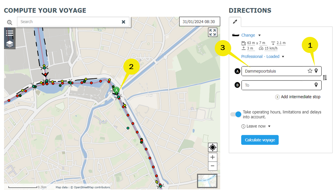
The start and end point of the route can be determined by clicking a
location on the map or by searching for a location from a list. It is
further possible to give more information like dimensions of the vessel,
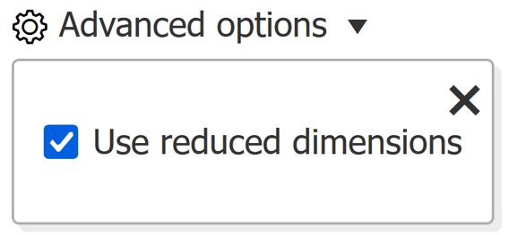
route points, type of vessel and the option to use reduced dimensions
(advanced options).
Based on these input parameters you will receive one or two results -
both the fastest and the shortest route will be calculated and
visualised except the case there is no difference in the search results,
then only one result is shown, which is indicated to the user in the
results header.
Note: please check the dimensions carefully. CEMT classes are for informative use only.
If you experience difficulties using the Route- or Voyageplanner, please contact us via the contact form
Location search
To use the planner and find the correct location, you may use one of the following methods:
A. Choose a location on the map:
1. Click on the "From" (or "To") pin
2. Click on the desired location on the map
3. The name of the chosen location appears in the corresponding textfield
B. Choose a location by the name:
1. Type the name of the location
2. The first 15 locations with this name appear in a list (sorted on type of object)
3. Select the desired location (this step is very important)
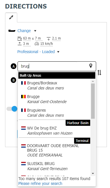
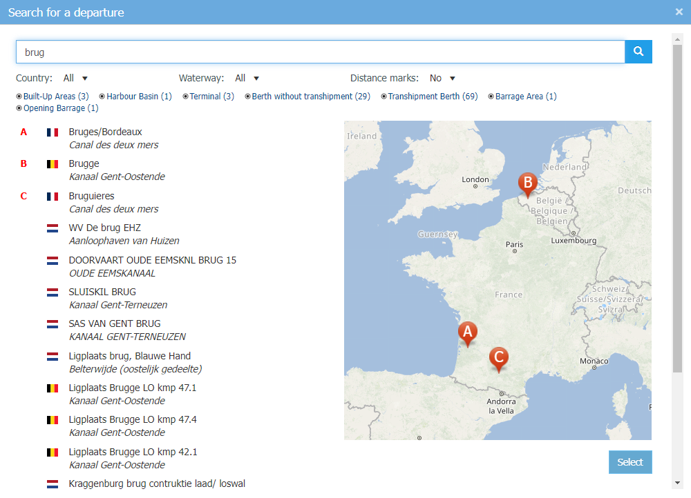
C. Advanced search options in case of more than 15 search results:
After clicking on “Please refine your search” you will be directed to
a advanced search where you can use several filter options to find the
correct location.
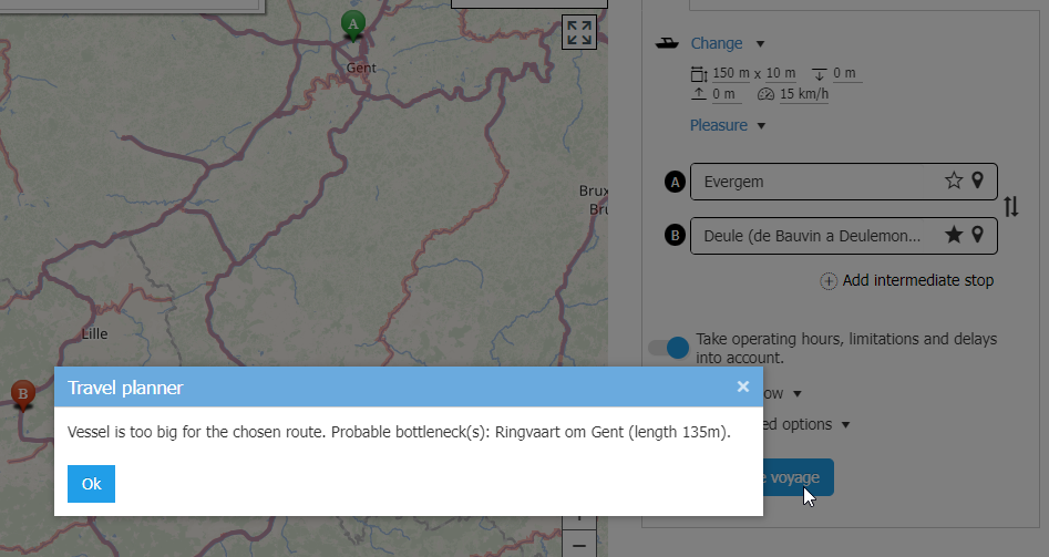
If the dimensions of your vessel exceed
the permissible dimensions for the desired route, EuRIS will calculate
an alternative route for reduced vessel dimensions and will notify you
if an alternative route is found.
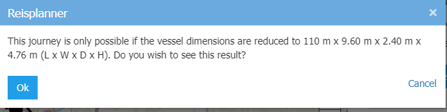
If you do not want the alternative route
calculations for reduced vessel dimensions, you can deactivate this
option via the “advanced options”.
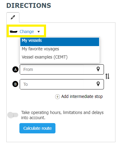
Favourite locations and voyages
1. You need to be registered and logged in to use this functionality
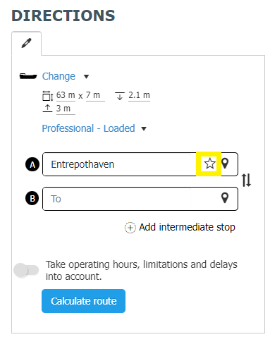
2. With a click on the "star" icon next to the location selection you can mark this location as favourite location
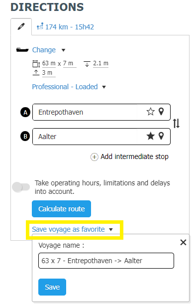
3. After calculating a route or voyage you can also save the voyage as favourite voyage
4. To do so, go back on the Input tab, click on "Save voyage as favourite", enter a name description and click on "Save"
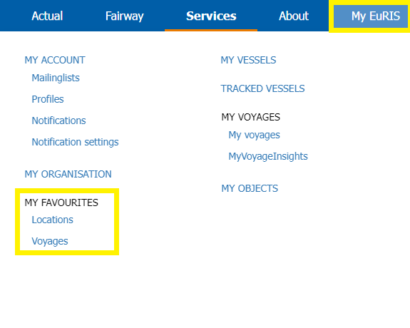
5. Both, the favourite locations and voyages are
available at My EuRIS --> My Favourites including the possibility to
edit or delete the items
6. To use a favourite voyage as search input you have to click on
"Change" and select the intended favourite (additional selection of own
vessels or predefined CEMT examples is also possible via this selection)
Presentation of search results
1. To calculate a voyage you have to enable the
selector "take operating hours, limitations and delays into account",
select a departure time under "Leave now" and press the button
"calculate voyage".
2. The search results provide the fastest and shortest voyage in 2 separate tabs. The yellow route indicates the selected one
3. The voyage description is displayed in 2 parts:
a. A summary of the information relevant
to the route, such as the tidal dependency, limitations, waterway
charges, border crossings, further information, the number of locks
passed and the permitted dimensions.
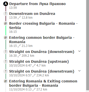
b. The detailed voyage description, which
is displayed in a condensed form providing the main route points. It is
possible to show individual or all details. In addition, parts of the
displayed route are highlighted when hovering over the direction
description.
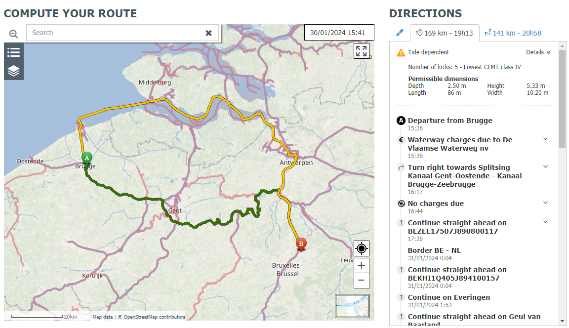
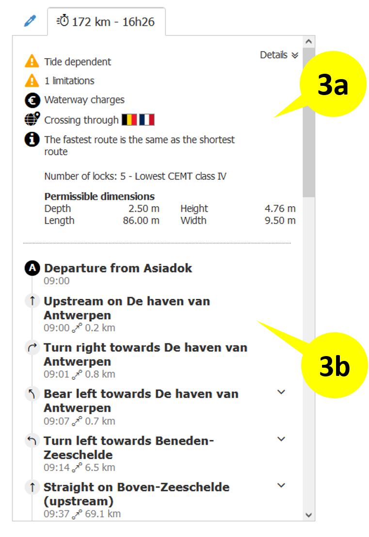
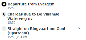
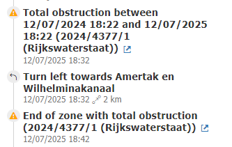
The limitations, waterway charges and border crossings are shown in the detailed voyage description as separate segments.
Error handling
The EuRIS route calculation takes various parameters into account. If
some of these parameters, e.g. start and destination location, ship dimensions,
blocking NtS, missing route connection, are not correct or fulfilled, no route
or voyage can be calculated.
In
this case, the user is notified of the problem with detailed error information
and may be able to resolve the problem themselves if necessary.
Read more...